Growth despite Ukraine war and supply bottlenecks. More flexibility and range through combination of copters. Geodesists rely on integrated combination of sensors. Legislation in the USA and Europe is moving.
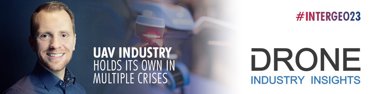
Mr. Wackwitz, you have been closely monitoring the industry for years with your market research company Drone Industry Insights. How did the market for drones develop last year?
Internationally, it can be seen that the market is growing and becoming more professional, and is steadily gaining traction. When it comes to legislation, we always look particularly closely at the USA, where a great deal is happening with regard to operations, especially the requirements for so-called NPRMs or, in Europe, the PDRA (Pre-defined Risk Assessment). The result is that operations are becoming much more scalable. Longer distances can be flown and therefore larger areas can be covered. All of a sudden, this is starting to be really fun. In Europe, the authorities haven't exactly been asleep either. There is interest and engagement with the technology. That doesn't mean the big plug has been pulled, but we're in a situation that's significantly better than it was a year ago. In terms of funding, last fall and winter were brutal compared to that. With the Ukraine war, investors have been playing it much safer and scaling back their bets on new (and potentially risky) products. If you didn't have funding last fall, you weren't going to get any for a while. That hurt a lot of small companies. As a result, many ideas did not even make it to market. The investment of the total market of unmanned aerial vehicles dropped from around 8 billion U.S. dollars (in 2021) to 4.8 billion U.S. dollars (in 2022). But as I said, despite all the difficulties, the market for professional unmanned vehicles is growing.
How has the surveying/monitoring/earth observation/localization/mapping segment performed?
A lot is happening, keyword multisensor technology. For example, laser scanning and optical cameras are being combined more often and are in daily use as a tandem. UAVs are now one tool among many that geodesists take for granted. The solutions are consistently getting smaller, handier, and are intuitive to use at the most professional level. This is a new stage of evolution. There are very handy solutions like the Hexagon BLK2Fly, an autonomous flying laser scanner that was even named one of the best inventions of 2022 by Time Magazine. In addition to the drones themselves, the processes are also becoming more and more professional, data processing, connectivity of the devices, all of this is now tuned to save a lot of time.
By the way, we are just finishing our 6th global drone survey - our Industry Barometer will soon be free for download and there you will also find the latest information on the development of the individual industries and fields of application.
Are there new technologies that will help drones find new applications in the geospatial segment?
It is rather the combination of technologies that are setting trends right now. As I said, for example, the combination of laser scanning and photography, or magnetometers and radar technology. There are no completely new technologies in the field - the credo is rather "low and slow", then there is the best data quality. If you want to fly long distances, you have to find a compromise between flight speed and data quality. As a new combination of technology (not in application, but in drone design), one can highlight the "VTOL technology" (Vertical Takeoff and Landing). It combines the advantages of fixed-wing drones (fixed-wings), with copters that can take off vertically into the air. You don't need a takeoff and landing infrastructure, you have a lot of flexibility in data acquisition, and you have much higher range. These will certainly be on display at INTERGEO.
Regardless of new technologies, are there new fields of application in the geo segment or an intensification of use in existing fields of application?
The whole topic of environmental monitoring, and forest monitoring in particular, is of course in great demand right now. In Germany, however, operations and their financing are very complex due to the federal structure. On the coast, the topic of flood protection is elementary; for example, the inspection of dikes is also carried out with drones. Climate change is bringing with it ever new fields of application for drones, too, because as flying sensors they can be deployed flexibly and quickly to provide an overview even at short notice.
What are the current hurdles to the use of drones?
As before, drones are usually only allowed to fly on sight. We have a densely populated airspace and have to share it with other aircraft. The motto is: safety first. So the drone market will remain a highly regulated market. The holy grail of the drone industry is called BVLOS (Beyond Visual Line of Sight) and describes flight beyond the pilot's line of sight. Uniform rules would give the market a huge boost. The European Aviation Safety Agency (EASA) is working on so-called standard scenarios. EASA is taking a very practical approach with PDRAs (Pre-Defined Risk Assessments). These describe specific scenarios - such as the inspection of a wind turbine or the surveying of a bridge or construction site. The first is the air risk, i.e. the risk of something colliding in the air, and the second is the ground risk, i.e. the risk of personal injury and damage to property in the event of a crash. For each scenario, there is a risk assessment and specifications that must be followed. In the USA, on the other hand, the FAA (Federal Aviation Administration) is trying to find a more general approach. Regardless of the approach, however, what they all have in common is that they are looking for a way to use drones as a tool over long distances. Acceptance is now high - you could say the drone has arrived in the middle of society. However, the Ukraine war is having a negative impact. The reputation is sinking if many people still perceive drones as weapons. That damages the entire reputation of the industry. I hope that this will change again soon and that there will be a greater differentiation between the types of operation.
Mr. Wackwitz, thank you for the interview.
The interview was conducted by Monika Rech-Heider